
New KN Thematic Maps – Easements, Land Categories, and Land Use
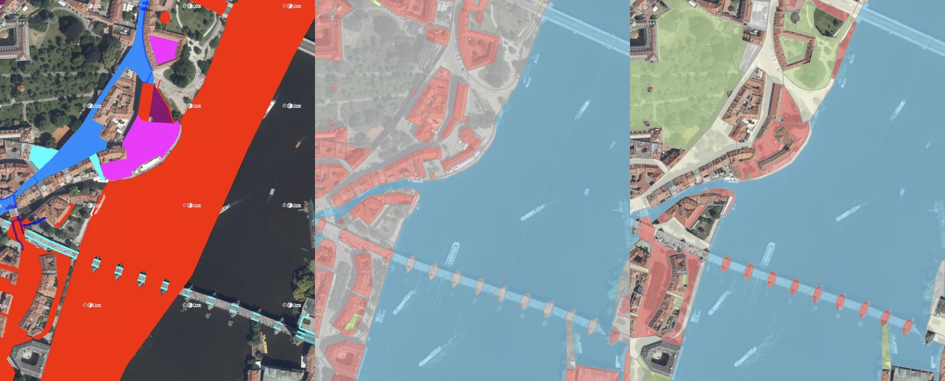
Three new thematic map layers from the Cadastral Register (KN) are now available on the Geoportal: easements, land categories, and land use.
New KN thematic maps on the MAWIS Geoportal: easements, land types, and land use.
The Czech Office for Surveying, Mapping, and Cadastre (ČÚZK) has expanded the Web Map Services (WMS) of the Real Estate Cadastre and has made three new thematic map layers available:
- Easements
- Types of Land
- Land Use
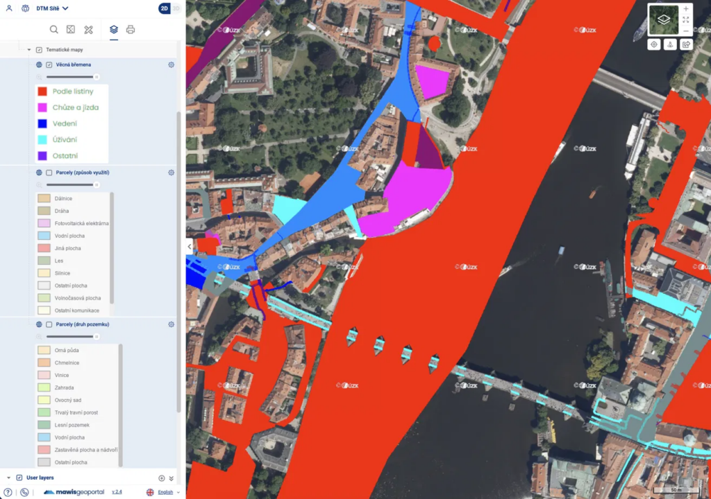
All layers are already integrated into every project in the MAWIS Geoportal. You can find them in the Layer Organizer under the Land Registry → Thematic Maps section.
1. Easements
This layer displays easements registered in the Real Estate Cadastre, color-coded by type:
- according to the document
- walking and driving
- management
- use
- others
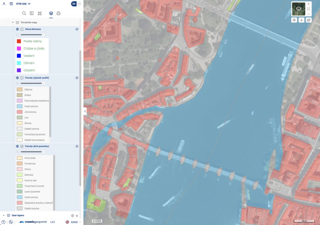
2. Types of Land
This layer classifies land parcels according to their type in the Real Estate Cadastre, with different colors used for clear visualization. The layer includes the following types of land: arable land, hop fields, vineyards, gardens, orchards, permanent grassland, forest land, water bodies, built-up areas and courtyards, and other areas.
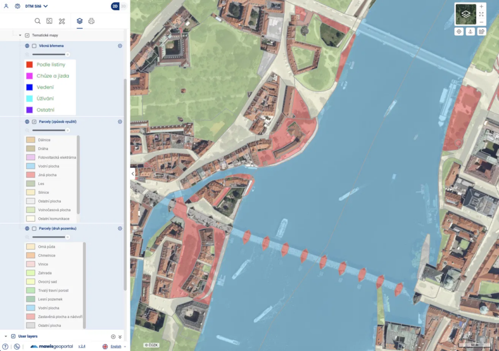
3. Land Use
An additional layer for the land use class—it specifies the type of land use. It allows for a more detailed analysis of the area without the need to download data from the Cadastral Register. The layer includes the following land uses: highway, railroad, photovoltaic power plant, body of water, other area, forest, road, miscellaneous area, recreational area, other roads, and other area.
4. Technical Notes
- The data comes from official sources of the Czech Office for Surveying, Mapping, and Cadastre (ČÚZK) and complies with the INSPIRE standard.
- The layers are available as WMS services retrieved directly from the ČÚZK infrastructure—the data is not stored locally.
- Updates are performed in accordance with the Land Registry's update cycles.
- The layers are optimized for smooth rendering even over larger areas.
Would you like to see other thematic maps on the Geoportal?
Please feel free to contact us. We'd be happy to help you with a custom solution.
Ladislav Bláha +420 724 863 431 | ladislav.blaha@hrdlicka.cz


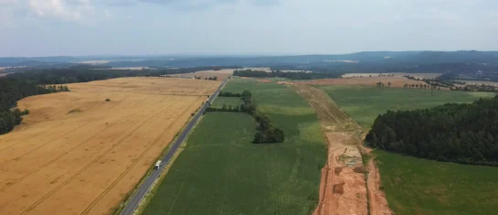
Map application to support the construction of linear infrastructure
A mapping platform that consolidates design, construction, and inspection data throughout linear construction projects.

MawisPasport – Effective Management and Maintenance of Green Spaces
Get an overview of green spaces and green infrastructure elements. A green space inventory is an important tool for the effective management of public spaces and maintenance planning.
MawisGeoportal as a tool for monitoring construction progress
An application for the construction of highway sections or the renovation of railway lines. It is suitable for linear construction projects, real estate development projects, and smaller construction projects.


