MawisGeoportal
Record of the applicant’s requests
In the app, you can track the status of all applications submitted by an applicant and attach supporting documents to them.
In the MawisGeoportal map application—Applicant’s Application History—you can track the status of all the applications you have submitted and add documents containing individual responses to them.
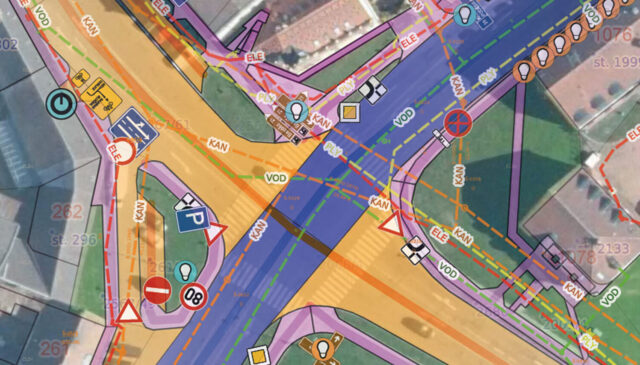
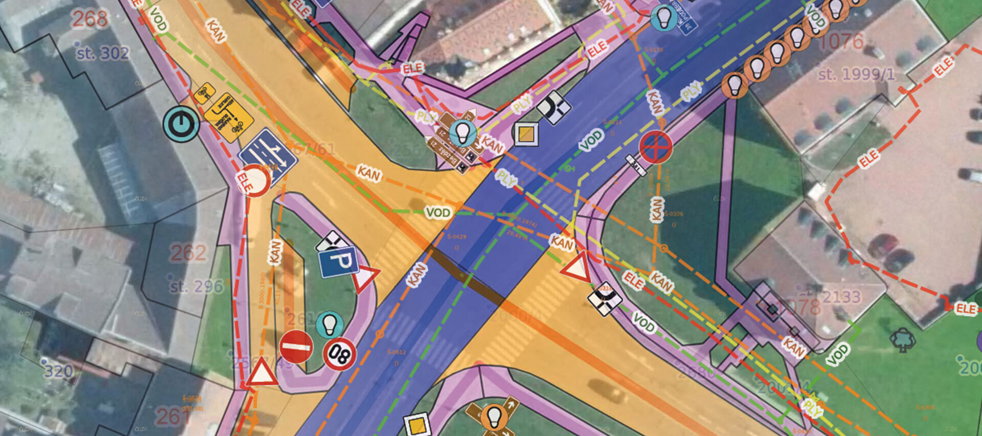
MawisGeoportal allows you to view requests overlaid on several base maps: orthophotos, base maps, the real estate cadastre, and the Digital Technical Map (DTM). The application also includes a viewer for drawings in a variety of geoformats (DGN, DWG, SHP, JVF DTM, and others).
Price List
The license will be activated within 3 business days after the order is completed.
Record of Applications
I can help you with MAWIS services
Customer Service Center
Not sure what to do? Ask our experts.
Oops! We could not locate your form.