

Map application to support the construction of linear infrastructure
A mapping platform that consolidates design, construction, and inspection data throughout linear construction projects.
The MawisGeoportal web-based mapping application has been developed as a central digital tool for managing, monitoring, and sharing spatial data during the implementation of linear and infrastructure projects.
The application is designed to meet the needs of investors and complies with the requirements set forth in the technical and quality specifications (TKP) for the construction project. In particular, it addresses the following issues:
- making up-to-date documentation available to project participants,
- monitoring of work progress against the project documentation,
- sharing of surveying, technical, and property data,
- clear records of changes and the actual construction work.
MawisGeoportal is technically ready for deployment as a shared data platform for investors, contractors, designers, and construction supervisors. It can also be accessed from mobile devices anywhere with an internet connection.
Typical map layers and data sources
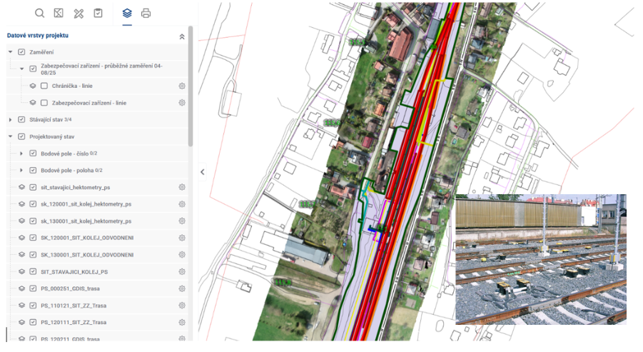
As part of the project, the following layers and datasets, in particular, can be displayed in the MawisGeoportal application:
- project documentation, including point fields and land acquisitions,
- a graphical representation of existing utility networks,
- a graphical representation of the construction process for new buildings and networks,
- ongoing as-built surveying,
- technological and security equipment,
- aerial surveying of the area (orthophotos, point clouds),
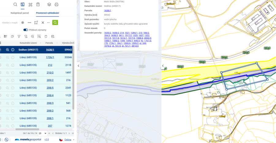
- a map layer showing the real estate cadastre and property relations,
- Digital Technical Map (DTM) data.
The data structure allows for the integration of design, construction, and inspection information within a single mapping environment.
Functional benefits of the construction solution
MawisGeoportal is designed to meet the practical needs of construction and inspection processes:
- access to data via a web application without the need for installation,
- easy sharing of up-to-date materials among project participants,
- on-site inspection of the construction process against the project documentation,
- an overview of property ownership in the area in question,
- Support for importing DWG, DXF, and JVF files,
- the ability to add notes, comments, and tasks directly to the map,
- storing photos and documents associated with specific locations in the area.
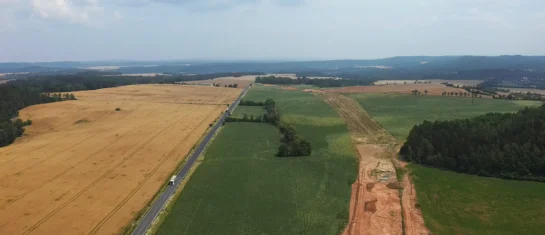
Sample scenario for use in linear construction
For example, the map application can display a construction axis (such as a railway track or road), which serves as a reference point for evaluating, measuring, and monitoring the implementation.
The solution includes a layer delineating the construction perimeter, which defines the project boundaries based on the investor’s documentation. Once this layer is activated, the investor’s designated project area is displayed, serving as a basic reference and control point during construction.
An important component of the solution is a layer of surveying results, which can be continuously added to the system as required by the construction project. This data serves as the basis for verifying the actual construction, documenting the progress of work, and assessing compliance with the design.
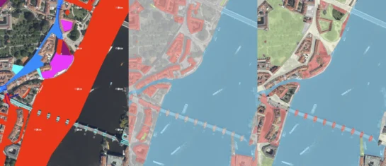
Also very useful is the aerial imagery layer of the area, including high-resolution orthophotos or point clouds, which provide a detailed overview of the current state of the area and the timeline—immediately before the start, during, and at key moments in the construction phases.
Video demonstration of the solution
Conclusion
MawisGeoportal is a ready-to-use digital solution that meets investors’ requirements for modern data management during construction projects and enables transparent, clear, and consistent handling of spatial information.
If you're interested in a demo of the app, we'd be happy to show you how it works.

New KN Thematic Maps – Easements, Land Categories, and Land Use
Three new thematic map layers from the Cadastral Register (KN) are now available on the Geoportal: easements, land categories, and land use.

MawisPasport – Effective Management and Maintenance of Green Spaces
Get an overview of green spaces and green infrastructure elements. A green space inventory is an important tool for the effective management of public spaces and maintenance planning.
MawisGeoportal as a tool for monitoring construction progress
An application for the construction of highway sections or the renovation of railway lines. It is suitable for linear construction projects, real estate development projects, and smaller construction projects.


