


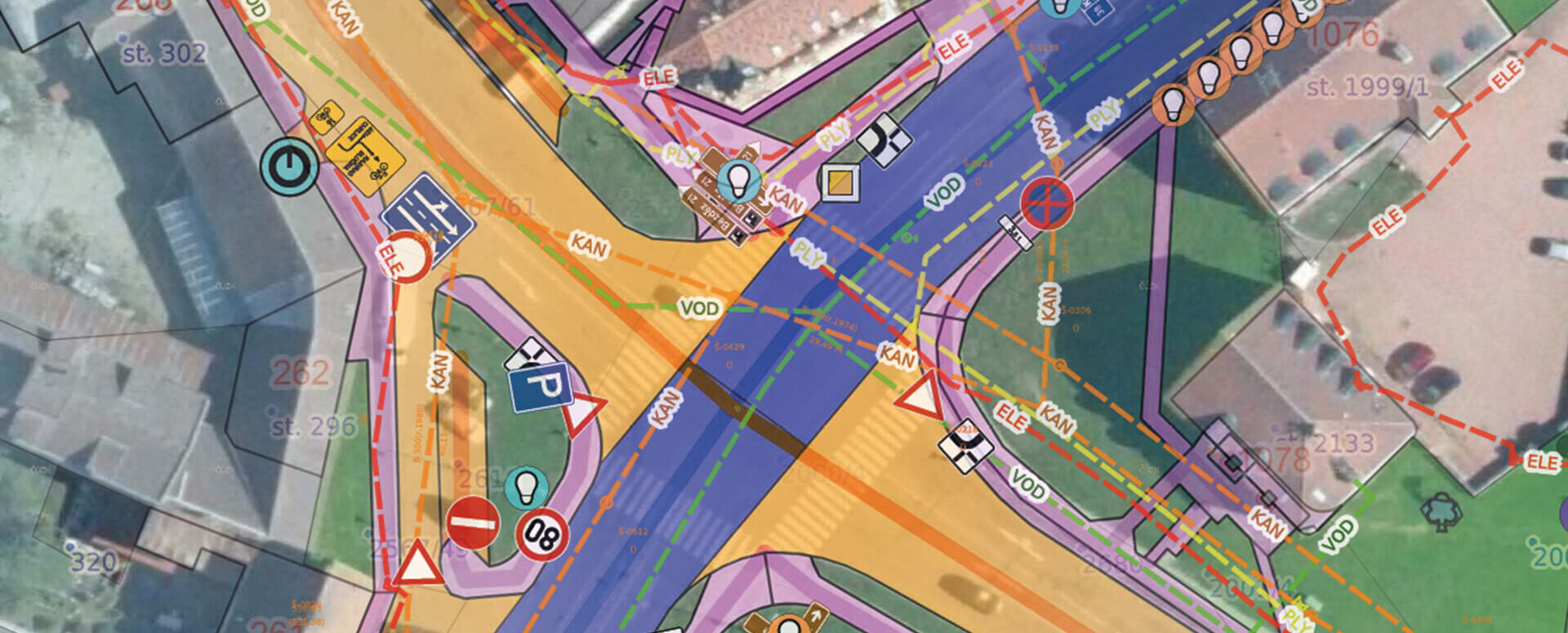
Custom Map – Create Your Own Map Layer
The Geoportal now offers custom map layers—create your own map layer tailored exactly to your needs.
The geoportal is no longer just about passively viewing maps. Thanks to the new “custom map” feature, it has become an active tool for the day-to-day operations of your municipality, city, or organization. Do you need to keep track of properties, monitor leases, manage land-use projects, or stay on top of planned investments? Our administrators will create a custom map layer tailored exactly to your needs.
What is a custom passport?
At its core, the Geoportal always includes standard features such as measurement tools, a land registry, and a task list. However, you can build a custom user layer on top of this foundation that precisely meets your specific needs. Whether you’re managing assets, organizing cultural events, or planning investments—a custom-built system lets you keep everything organized and in one place.
What does a customized passport mean in practice?
- Do you have a list of objects with geometry and attributes? → We’ll simply digitize them and display them on the Geoportal.
- A registry of vendor stands or other temporary structures in the area—such as those used for regular public events, markets, or festivals.
- Lease management—for example, of municipal land, parking spaces, or real estate.
- Investment Plans – Clear planning of small-scale construction projects, including deadlines and progress tracking.
- Comparing Plans and Reality – a visual representation that helps you track what actually happened compared to the original plans.
Specific examples from municipalities
The municipality of Tetín is an active user of this feature and has created several custom layers:
- Investment Plans – an overview of projects such as road repairs or the construction of a playground. Each entry is linked to the construction log and supporting documentation.
- “Non-cooperative owners” layer – facilitates event planning by highlighting properties where cooperation is more difficult.
- Layer of known owners – helps quickly identify whether a parcel of land is managed by the Vltava River Basin Authority, the Railway Administration, Lesy ČR, etc.
- Record of rented stalls – for regular markets in the square.
- Coordination of public events—overview of areas required for the event, space allocation, and planning for the movement of people and equipment.
A hassle-free technical solution
You don’t need to be an IT expert. All you need is an Excel spreadsheet with basic data—our administrators will use it to create a layer for you in the Geoportal. The layer can be:
- point, line, or polygon—depending on the type of recorded features,
- editable – you can add new entries, edit them, or delete them,
- linked to documents—such as construction logs, contracts, or blueprints.
Basic data is often created outside of a map—for example, in Excel. However, thanks to the Geoportal, it gains a spatial dimension, visualization capabilities, and intuitive controls.
Why create your own passport?
- Clarity – everything you need in one place and linked to a map.
- Flexibility – the layers adapt to the way you work, not the other way around.
- Easy maintenance – add, edit, and delete without any programming required.
- Better coordination—for example, at public events or with regard to investments.
- Modern technology – The geoportal operates on a database rather than as a static tool.

More similar articles
New KN Thematic Maps – Easements, Land Categories, and Land Use
Three new thematic map layers from the Cadastral Register (KN) are now available on the Geoportal: easements, land categories, and land use.

Map application to support the construction of linear infrastructure
A mapping platform that consolidates design, construction, and inspection data throughout linear construction projects.

MawisPasport – Effective Management and Maintenance of Green Spaces
Get an overview of green spaces and green infrastructure elements. A green space inventory is an important tool for the effective management of public spaces and maintenance planning.


