


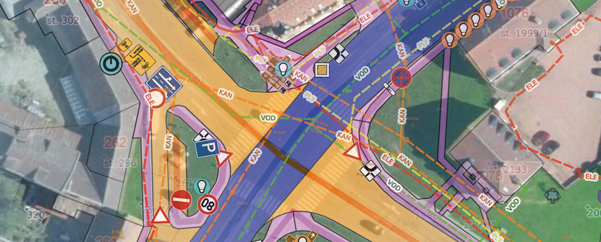
MawisGeoportal – A Revolution in Data Management and Sharing
MawisGeoportal for the effective visualization, publication, management, and sharing of your geodata and related documents.
Introducing MawisGeoportal, an innovative cloud-based mapping application that will transform the way you manage, visualize, and share your geodata and related documents. It will bring a whole new level of efficiency and clarity to your work with spatial data.
It is designed for cutting-edge visualization, easy management, publication, and sharing of geodata—simply and efficiently. With MawisGeoportal, you’ll save hours of work and significantly boost your team’s productivity.
Key benefits of MawisGeoportal:
1. Intuitive and user-friendly interface – MawisGeoportal offers a modern and intuitive user interface that makes it easy to navigate and work with data. A clear map window, full-text search, and easy layer management allow you to quickly find and view the information you need.
2. Everything in One Place – With MawisGeoportal, you’ll have all your geodata in one place, ready for immediate use. Whether it’s technical maps, property records, utility networks, or cadastral data, everything will be clearly organized and accessible in a single application.
3. Efficient Data Management and Updates – The geoportal allows you to easily manage and update your data in real time. You can add, edit, and delete features directly in the map window and see the changes immediately. Thanks to the cloud-based solution, your data will always be up to date and accessible from anywhere.
4. Seamless Sharing and Collaboration – With MawisGeoportal, you can easily share your data with colleagues, partners, or the public. Set access rights for individual users or groups and collaborate effectively on the same data in real time.
5. Advanced Features and Tools – The Geoportal offers a wide range of advanced features, such as measuring distances and areas, creating spatial queries, printing maps, adding your own data, and much more. This gives you all the tools you need to analyze and work with spatial data.
6. Support for Various Formats and Standards – MawisGeoportal supports all standard data formats, including digital technical maps (DTM) and communication with the Public Administration Digital Map Information System (IS DMVS). You can easily import and export data in various formats, ensuring seamless integration with other systems.
Whether you’re a network operator managing technical and transportation infrastructure, a municipality or region responsible for public assets and the digital technical map of the Czech Republic, a builder seeking support from design through construction, or a designer analyzing data, MawisGeoportal is the right choice. Simplify your work, save time and resources, and take your organization to the next level with our innovative mapping application.
Contact us today for a demonstration of all the benefits of MawisGeoportal, tailored to your needs. We’re ready to help you streamline your geodata management.
Assistance with data preparation
As a surveying firm with an extensive GIS department, we provide not only software tools but also initial data preparation, ongoing data management, and support throughout every stage of implementing the mapping application into your practice. Thanks to this, MawisGeoportal will make your life easier and allow you to focus on what really matters.
We look forward to working with you!

More similar articles
New KN Thematic Maps – Easements, Land Categories, and Land Use
Three new thematic map layers from the Cadastral Register (KN) are now available on the Geoportal: easements, land categories, and land use.

Map application to support the construction of linear infrastructure
A mapping platform that consolidates design, construction, and inspection data throughout linear construction projects.

MawisPasport – Effective Management and Maintenance of Green Spaces
Get an overview of green spaces and green infrastructure elements. A green space inventory is an important tool for the effective management of public spaces and maintenance planning.


