



What is the Digital Technical Map of the Czech Republic used for?
The DTM of the Czech Republic represents a huge step forward in the fields of geodesy and land-use planning, and its benefits will be indispensable in the construction process.
The Digital Technical Map of the Czech Republic (hereinafter referred to as DTM) project is massive. It is the largest in the history of data collection actually conducted by surveyors in the field across the entire territory of the Czech Republic. The Digital Technical Map is becoming the project of the century. Nothing on a larger scale has yet been built in the field of geodesy.
However, as is often the case, the development of the DTM was—and continues to be—rushed.
Working in collaboration with surveying firms, the private sector managed to prepare the base data for the DTM in 1.5 years.
From the outset, the DTM project has faced a number of objections:
- What good will DTM actually do for us?
- There will be problems with its future maintenance!
- There will be inaccuracies!
- This will add to the workload of surveyors, who will have to upload each of their measurements somewhere!
- The DTM will remain incomplete for a long time, and some data will be missing!
While all of that is true, the disadvantages of the DTM system will be offset by its enormous benefit—making data on utility networks available to the public in a new, fast, and easily understandable way. This change has the potential to truly simplify and accelerate building permit processes and land-use planning.
Something is taking shape that has no rival anywhere in the world. A unified system. For the entire country. Just as we have a unique digital system for managing information on cadastral parcels, their owners, and easements—a system that is exceptional and leading in the world, whose accessibility and clarity are the envy of many developed countries—a similarly innovative project is taking shape in the case of the DTM.
The DTM ČR provides data in a standardized format on the location of transportation and utility infrastructure (e.g., sewer lines, water mains, hot water pipes, power lines…) —everything that happens beneath the surface and is not easily visible, yet significantly impacts any construction project and further development of the area.
DTM data is being prepared and will be required in 3D format in the future, meaning it will include elevation data, which is revolutionizing the current world of 2D maps and utility network drawings.
DTM brings order to the existing world of proprietary CAD data formats (*.dgn, *.dxf, *.dwg…), which lack a unified internal data representation structure and data standard. It introduces the unified JVF DTM exchange format, which will be consistent for all DTM data; once users learn to utilize it, it will serve as a common language for all stakeholders: network administrators, municipalities, regions, designers, surveyors, and others, including the construction community.
Utility companies will have to disclose their data on the location of their utility lines to the public “in their own interest” for construction investment projects, so that incidents like an excavator operator getting electrocuted—because he happened to hit a live cable that was drawn in the original 2D documentation without the depth specified—should no longer occur.
The goal of the DTM ČR project is to speed up the preliminary stages of the building permit process. No one will be able to claim they don’t have the data anymore.
They will be available in the digital technical map for the entire country. They will be presented in a uniform format for all regions, regardless of the practices of local building authorities or the format of local municipal or regional digital technical maps, which were maintained separately in some progressive parts of the country.
All elements recorded in the DTM are linked to construction processes and land-use planning.
Updating data in the Digital Terrain Model (DTM) is designed to be a mandatory part of the final building inspection process; just as geometric plans are currently prepared, developers will also be required to conduct surveying for utility connections for the purpose of updating the DTM.
Until the survey data for the DTM update is submitted to the regional DTM office, the condition for the final building inspection will not be met.
What is not yet known is how much it will actually cost to maintain the DTM data. Only time will tell.
At Mawis, we are, of course, working intensively on DTM and its data.
From the very beginning, we designed the geoportal as a versatile tool for working with
- Digital Technical Map – viewing and managing a complete digital technical map in accordance with the requirements of the DTM ČR,
- The entity’s utility networks—the owner’s transportation and technical infrastructure, including the ability to provide input on the networks,
- Asset inventories – all your inventory data in one place, where you can easily attach documents, contracts, and photos,
- Land Registry – advanced features and search capabilities for land registry data,
- Specialized base maps – all objects in your network can be displayed alongside additional information, such as orthophotos, flood maps, 3D terrain models, and much more.
To see just how easy it will be in Mawis, check out our YouTube video, where I demonstrate what the entire data processing workflow will look like.

More similar articles
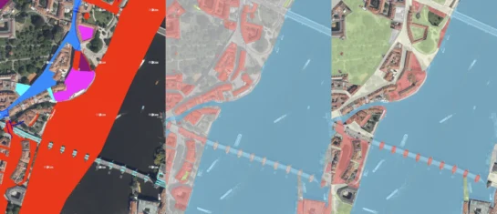
New KN Thematic Maps – Easements, Land Categories, and Land Use
Three new thematic map layers from the Cadastral Register (KN) are now available on the Geoportal: easements, land categories, and land use.

Map application to support the construction of linear infrastructure
A mapping platform that consolidates design, construction, and inspection data throughout linear construction projects.

MawisPasport – Effective Management and Maintenance of Green Spaces
Get an overview of green spaces and green infrastructure elements. A green space inventory is an important tool for the effective management of public spaces and maintenance planning.


