


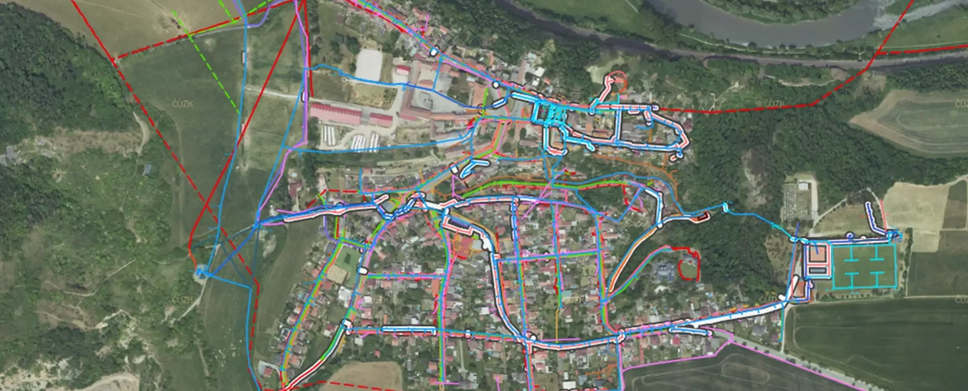
The Geoportal is a digital assistant for every municipality
MawisGeoportal is a modern web application that serves as a digital assistant for the efficient management of your municipality's assets.
📖 Article in Deník veřejné správy (dvs.cz): MawisGeoportal – a digital assistant for every municipality.
Managing municipal assets is one of the most important and demanding tasks for every mayor, council member, and municipal administrator. Collecting, managing, and sharing spatial data on municipal property, networks, buildings, and other infrastructure elements is often a major challenge, especially for smaller municipalities. Many of them struggle with a lack of financial and human resources that could be allocated to this task. In addition, they must fulfill the obligations arising from the Surveying Act, namely cooperation with the Digital Technical Map (DTM) of the Czech Republic. The newly introduced Mawis Geoportal is designed to address these challenges and offers a range of useful features tailored specifically to the needs of small municipalities.
Comprehensive data management in a single application
Mawis Geoportal is a comprehensive web application that brings together all the necessary features for the effective management of a municipality’s spatial data. Unlike typical GIS solutions, which are often complex and difficult to use, Geoportal was designed so that even a complete novice can use it. At the same time, it offers a wide range of options for more advanced users who rely on the tool for their daily work.
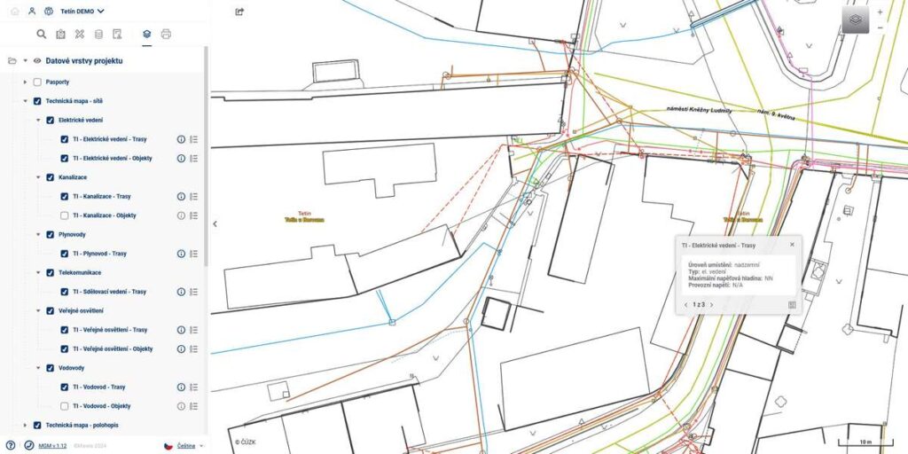
In the Geoportal, you can conveniently manage the records for all of your municipality’s assets—buildings, roads, streetlights, playgrounds, trees, benches, and much more. All data is stored in a central database and accessible from anywhere on your computer or tablet. Thanks to the intuitive user interface and modern tools, updating and adding new information is a breeze.
A suitable tool for fulfilling obligations to DTM ČR
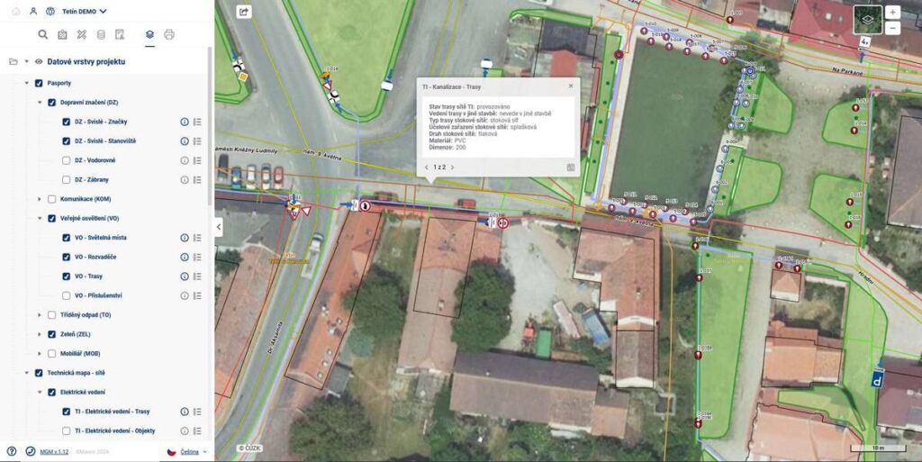
The Mawis Geoportal directly supports municipalities in fulfilling their obligations regarding the Digital Technical Map of the Czech Republic. The Surveying Act requires municipalities to provide and update data on their assets, networks, and other infrastructure elements. The Geoportal fully covers this requirement—it includes tools for easily cataloging individual elements, managing them, and seamlessly exchanging data with the DTM of the Czech Republic. Municipalities can thus fulfill their legal requirements efficiently and without unnecessary administrative burden.
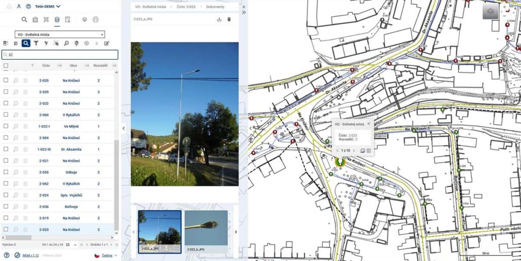
A fully mobile solution
To support fieldwork with asset records, the Mawis Geoportal was developed as a fully mobile solution. You can access the application not only from a computer but also from a tablet. This allows you to immediately add, update, or verify data right where your assets are located. Whether it involves adding a new infrastructure element to the records, taking photos, or logging defects and repair requests.
Effective data sharing and presentation
The Mawis Geoportal does more than just manage its own spatial data. One of its key functions is to enable the secure and efficient sharing of this data with other entities, whether they are citizens, businesses, or other government agencies.
Designed for small communities
Although the Mawis Geoportal is a comprehensive solution, it was designed to meet the needs of even the smallest municipalities. Compared to traditional GIS systems, it is significantly simpler and more intuitive to use. At the same time, it is flexible enough to meet the requirements of even the largest cities.
Today, digitization and efficient asset management are essential for every modern municipality, whether it is a small village or a larger city. The geoportal offers a comprehensive yet user-friendly solution that will significantly simplify these tasks. Thanks to its intuitive controls, mobile accessibility, data-sharing capabilities, and direct support for fulfilling obligations to the DTM ČR, it helps save valuable resources and focus on the most important priorities.
30-day free trial of the geoportal

More similar articles
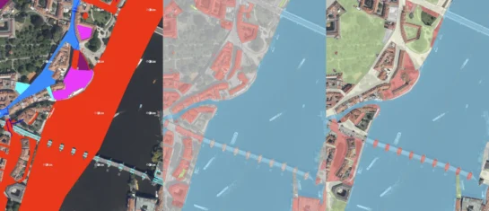
New KN Thematic Maps – Easements, Land Categories, and Land Use
Three new thematic map layers from the Cadastral Register (KN) are now available on the Geoportal: easements, land categories, and land use.

Map application to support the construction of linear infrastructure
A mapping platform that consolidates design, construction, and inspection data throughout linear construction projects.

MawisPasport – Effective Management and Maintenance of Green Spaces
Get an overview of green spaces and green infrastructure elements. A green space inventory is an important tool for the effective management of public spaces and maintenance planning.


