

How do I obtain a record identifier in the Digital Technical Map?
It is now mandatory to provide the Digital Technical Map record identifier when applying for a building occupancy permit. We can help you with this.
Do you need a Digital Technical Map (DTM) record identifier for the final building inspection?
Does the building authority or other legal authority require you to provide proof that the infrastructure data has been uploaded to the DTM?
With the transition to routine operation of the DTM, a requirement under the Building Act came into effect, mandating that investors demonstrate that newly created or modified elements of transportation and technical infrastructure have been recorded in the DTM.
This requirement is documented by a record with the identifier under which the infrastructure was stored in the DTM.
What has changed compared to the past?
In the past, the following was generally sufficient for final inspection:
- submission of a survey plan prepared by a licensed surveyor.
A geometric plan is no longer sufficient. The authorities require:
- Confirmation of data upload to the Digital Technical Map,
- that is, the DTM record identifier.
Why don't surveyors often upload data to the DTM?
A surveyor who conducts a survey of a building and its infrastructure often:
- is not familiar with the new DTM procedures, or
- does not have the necessary software to connect to the DMVS Information System (Digital Map of Public Administration – DTM portal).
Data is uploaded to DTM via the API and requires:
- knowledge of the DTM data model,
- working with exchange formats (JVF DTM),
- permissions for a specific role in the DMVS system.
How can we help you with that?
We can act on behalf of a surveyor and handle the entire process of uploading data to the DTM.
What we can do for you:
- We will incorporate the as-built documentation (DSPS),
- we will transfer the data to JVF DTM,
- We will create sections and ranges in DTM,
- We will upload:
- elements of transportation and technical infrastructure,
- documentation of protection zones,
- The result is a DTM record identifier, which you will use for final approval or when dealing with government agencies.
What do we need from you to upload to DTM?
- Surveying
- including the stamp of a licensed surveyor,
- its verification number.
- Authorization in the DMVS Information System
- the "founder" role,
- granted by the owner of the infrastructure under construction.
Result
- compliance with a legal obligation,
- smooth dealings with the building or water authority,
- timely submission of the DTM record identifier for the final inspection proceedings.
We can help you with the Digital Technical Map.
Contact Information
Would you like to know more? Please don't hesitate to contact us.
Ladislav Bláha +420 724 863 431 | ladislav.blaha@hrdlicka.cz
Miroslava Kubíčková +420 602 477 250 | miroslava.kubickova@hrdlicka.cz


Handover without complications—we’ll handle the data entry into the Czech Republic’s Digital Terrain Model (DTM) for you
Are you finalizing the building inspection? We'll take care of entering the data into the DTM ČR and issuing the PGAD and EDTI identifiers for you.
Digital Technical Map and MAWIS Services – Potential for Construction, Management, and Maintenance
MAWIS's digital services, in conjunction with the Digital Technical Map, support the construction process in the Czech Republic.

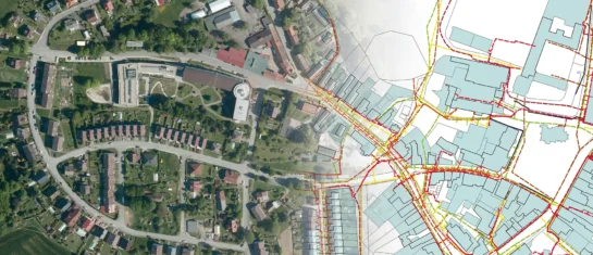
DTM ČR – A New Tool for Infrastructure Management and Planning
DTM consolidates previously fragmented data into a single digital model that can be used by both the public and private sectors.


