
Digital Technical Map and MAWIS Services – Potential for Construction, Management, and Maintenance
MAWIS's digital services, in conjunction with the Digital Technical Map, support the construction process in the Czech Republic.
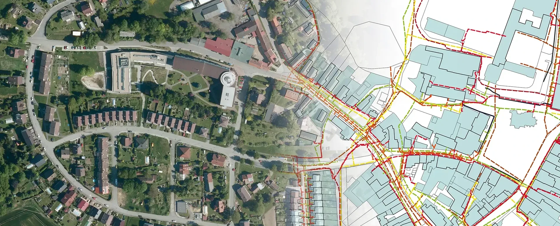
The Digital Technical Map of the Czech Republic is a revolutionary tool for providing access to data on technical and transportation infrastructure, as well as basic spatial information, across the entire country. By using the Unified Exchange Format (JVF), users can work effectively with up-to-date and accurate data, which speeds up the preparatory phases of construction projects and minimizes the risk of damage to existing infrastructure.
DTM data is available through regional systems, with basic information freely accessible. This approach promotes transparency and significantly improves the efficiency of construction processes. The project is designed as a long-term initiative, with an emphasis on continuously updating and refining the data. It facilitates construction planning, building permit applications, and the final inspection process, thereby significantly contributing to the digitization of construction management.
Thanks to the open data from the Czech Republic’s Digital Terrain Model (DTM), new services are being developed that help both the public and professionals address issues throughout the life cycle of structures. The MAWIS portal provides tools that are fully compatible with the Czech Republic’s DTM. As a result, network operators, builders, designers, municipalities, and regions now have online access to various digital services.
MawisGeoportal is a mapping application used to visualize, manage, and share geographic data and related documents, including 3D data. This tool facilitates strategic planning and asset management by providing access to technical maps showing utility networks, property records, cadastral maps, and other key mapping data.
It is still necessary to add missing data on utility networks to the DTM ČR, including refining their locations. This is one reason why, when preparing for construction, it is necessary to ask utility companies for confirmation of the existence of utility networks. The MawisUtility service, with nationwide coverage and more than 400,000 requests per year, serves this purpose. It is an indispensable part of the preparation for any construction project.
📖 Article in TEPKY NEWS 2026 – Issue 1: Digital Technical Map (DTM) and MAWIS – Potential for Construction, Management, and Maintenance.


Handover without complications—we’ll handle the data entry into the Czech Republic’s Digital Terrain Model (DTM) for you
Are you finalizing the building inspection? We'll take care of entering the data into the DTM ČR and issuing the PGAD and EDTI identifiers for you.

How do I obtain a record identifier in the Digital Technical Map?
It is now mandatory to provide the Digital Technical Map record identifier when applying for a building occupancy permit. We can help you with this.

DTM ČR – A New Tool for Infrastructure Management and Planning
DTM consolidates previously fragmented data into a single digital model that can be used by both the public and private sectors.


