

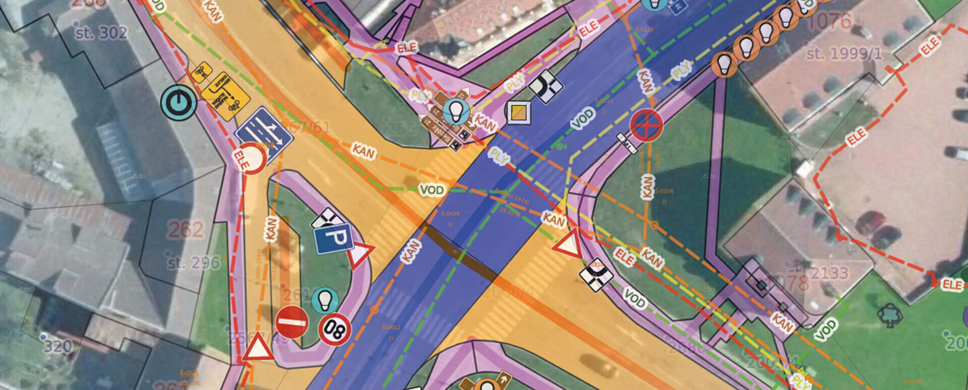
Mapping of Municipal Assets – Modern Management with Mawis
The MawisPasport service will help municipalities consolidate and digitize their records, making them accessible to anyone who needs them.
Asset management is a fundamental and highly complex task for a municipality. It involves maintaining local roads, traffic signs, street lighting, street furniture, green spaces, cemeteries, and municipal buildings. Proper record-keeping is essential for investment planning, maintenance, financing, and interactions with residents, and can simplify and streamline asset management.
Investing in a digital record-keeping system that consolidates fragmented documents stored on paper, on outdated media, or even with individual employees will quickly pay off in the form of more accurate and streamlined management.
The solution is asset inventory management—the systematic consolidation and digitization of data using the MawisPasport service.
What the passport offers the community
The Property Register is a user-friendly database of municipal property that links a map with detailed information about individual properties. It offers a number of practical benefits:
- a complete overview of your assets in one place,
- easier management and maintenance of individual components,
- cost savings (e.g., on landscaping, roads, or street furniture),
- clear guidelines for budgets and investments,
- supporting documents for grant applications and mandatory audits,
- clarification of property rights where proof of ownership is required.
Mapping is a tool that saves municipalities time and money and provides a clearer overview of their operations.
What does a passport look like?
Each passport consists of three main sections:
- A map showing the locations of various features—roads, signs, streetlights, greenery, and more—is clearly marked.
- Descriptive information – each element is associated with attributes such as status, date of creation, and the person responsible.
- Attached documents – photos, inspection reports, contracts, or technical data sheets.
A field guide compiled in this way provides an immediate overview that can be used both in the office and in the field.
How passports Are Made
Data for property records can be obtained in various ways, depending on the type of registry and the municipality’s needs:
- surveying,
- 3D laser scanning,
- mapping using a drone,
- by converting and consolidating existing source materials.
The result is an accurate and up-to-date database that can be further developed and maintained.
Integration with the Digital Technical Map (DTM of the Czech Republic)
Cadastral records are closely linked to the Digital Technical Map of the Czech Republic (DTM ČR). A well-maintained DTM becomes a valuable source of data that can also be used for cadastral record-keeping. Conversely, certain cadastral records—such as those for technical infrastructure networks—serve as source data that must be incorporated into the DTM. As a result, municipal records are compatible with the national standard and meet legislative requirements.
Data Sharing and Management in MawisGeoportal
The cadastre itself is the foundation, but its usefulness is greatly enhanced when it is available online. MawisGeoportal allows you not only to create and manage cadastres, but also to easily share them:
- access for individual departments and employees,
- secure cloud data storage,
- the ability to attach documents and photos,
- Working in the office and in the field using mobile devices.
This eliminates the problem of scattered records—everything is in one place and always up to date.
In conclusion
Inventorying municipal assets is a step that provides clarity, savings, and better planning. The MawisPasport service helps municipalities standardize and digitize their records, and—with the help of MawisGeoportal—makes them accessible to everyone who needs them.
This allows mayors, department heads, and officials to work with up-to-date and easily understandable data, which simplifies asset management and decision-making regarding the future of those assets.
Would you like to have better tools for your municipality’s land registry?
Contact us—we’ll show you how Mawis can simplify asset management in your municipality.
Miroslava Kubíčková +420 602 477 250 | miroslava.kubickova@hrdlicka.cz
Ladislav Bláha +420 724 863 431 | ladislav.blaha@hrdlicka.cz

More similar articles

A Cemetery Guide for Your Community
We can create or update your cemetery inventory. Contact us and we’ll discuss the next steps.
Property records are used to manage the assets of each municipality
MawisPasport helps with planning investments, maintenance, and financing, and makes it possible to simplify and streamline the management of municipal assets.

A Green Passport for Your Community
Get an overview of green spaces and green infrastructure elements. A green space inventory is an important tool for the effective management of public spaces and maintenance planning.


