



The regions' DTM systems are finally aligned—what about your data?
Regional DTM data is finally fully available from a single source. Have you already uploaded your data to it?
Dear Network Administrators,
The DTM data for the regions, which were previously stored using a common system for twelve individual regions and a separate system shared by Prague and the Central Bohemian Region, have finally been harmonized.
DTM data for any area in the Czech Republic can be fully viewed from a single WMS source.
We at Hrdlička have prepared a new DTM ČR map layer for our partners to use in their geoportals, where they can view the data. We provide access to this layer through the MawisGeoportal DTM application, as well as to any other interested parties.
To ensure that maps provide complete information about the area, they should also include the location of your infrastructure.
This is a legal requirement, and failure to provide the data may result in legal consequences, particularly in the event of damage to your network. If your network suffers physical damage in the field, you will be liable for the damage; no one else will reimburse you for it—see the Building Act.
30-day free trial of the geoportal
At Hrdlička, we have already provided—or are currently providing—geolocation data for transportation and technical infrastructure to more than a hundred administrators across the country. If you have not yet fulfilled this requirement, please contact us.
We’ll help you prepare your data, upload it to the system, and keep it up to date in the future.
Do you need advice on something? We’re here to help via email or phone.
Ladislav Bláha

More similar articles
Handover without complications—we’ll handle the data entry into the Czech Republic’s Digital Terrain Model (DTM) for you
Are you finalizing the building inspection? We'll take care of entering the data into the DTM ČR and issuing the PGAD and EDTI identifiers for you.
How do I obtain a record identifier in the Digital Technical Map?
It is now mandatory to provide the Digital Technical Map record identifier when applying for a building occupancy permit. We can help you with this.
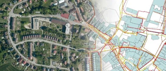
Digital Technical Map and MAWIS Services – Potential for Construction, Management, and Maintenance
MAWIS's digital services, in conjunction with the Digital Technical Map, support the construction process in the Czech Republic.


