


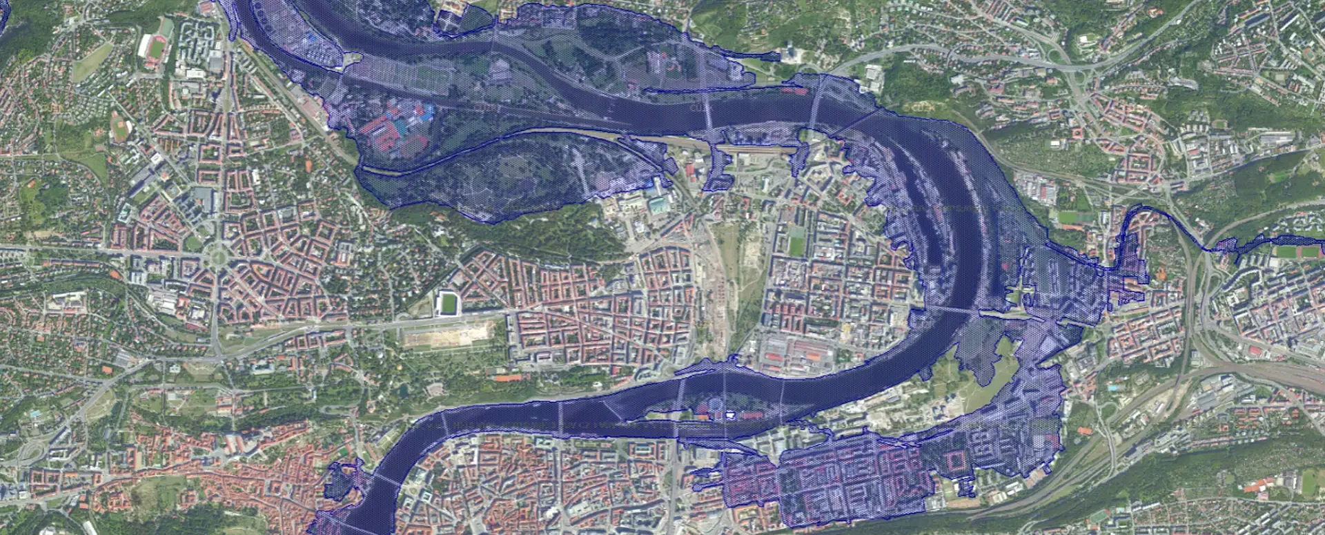
Orthophotos and floodplains – supporting documentation for statements regarding the existence of utility networks
Flood maps and orthophoto maps provide clear visual information, not only for assessing the existence of infrastructure networks, but also for construction and design work.
Orthophotos and floodplains as supporting documentation for statements regarding the existence of utility networks
The MawisUtility app simplifies the process of submitting requests for information on the location of utility networks by allowing users to easily map their area of interest and cross-reference it with other map data. The most commonly used are orthophoto maps, cadastral maps, floodplains, protected areas, geological maps, and ecological corridors. This allows users to obtain essential information about the area for planning construction projects.

Orthophoto maps and their significance
Orthophoto maps (aerial imagery) provide high-resolution, detailed imagery, allowing users to visualize physical infrastructure elements such as buildings, roads, power lines, and more. This visual context is crucial for infrastructure managers when assessing the status of networks.
Using orthophoto maps, users can identify and mark specific elements that need to be included in the report on the existence of utility networks. For example, they can mark the locations of distribution boxes, water connections, sewer lines, fiber-optic cables, and other utility networks.
Floodplains and Their Use
The flood maps available in MawisUtility add another dimension to the assessment of infrastructure networks. These maps contain historical flood data and allow users to visualize risks in the landscape. Together with orthophoto maps, they provide a clear picture of areas where a planned construction project could be at risk.
Both users and infrastructure managers can use flood maps to effectively plan for and prevent flood events. Identifying areas at high risk of flooding helps in designing and expanding utility networks to make them more resilient to natural disasters.
Benefits for Project Planning and Crisis Management
Orthophoto maps and floodplain maps provide valuable information not only for assessing the status of utility networks but also for the overall management and operation of those networks. They make it possible to:
- Pinpoint the location of existing infrastructure,
- Assess the risks associated with natural conditions,
- Effectively plan new projects and ensure their security,
- Ensure that infrastructure is resilient to floods and other threats.
MawisUtility offers comprehensive and easily accessible tools for anyone involved in the preparation of construction plans and the design of utility networks, enabling informed decisions based on detailed map data.

More similar articles
MawisUtility – 17 Years of Digital Support for Construction Management
For more than 17 years, a digital tool has been available that makes it significantly easier for builders and designers to submit requests for information regarding the location of utility lines.

MAWIS Service Integration – Complete Overview of Requests
In the MawisGeoportal environment, you can track the status of all requests submitted by an applicant in the MawisUtility application (this information is transferred automatically).
MawisUtility – DTM integration and other new features in the app
Key features of MawisUtility – integration with the Digital Technical Map – overview of submitted requests and responses in MawisGeoportal.


