


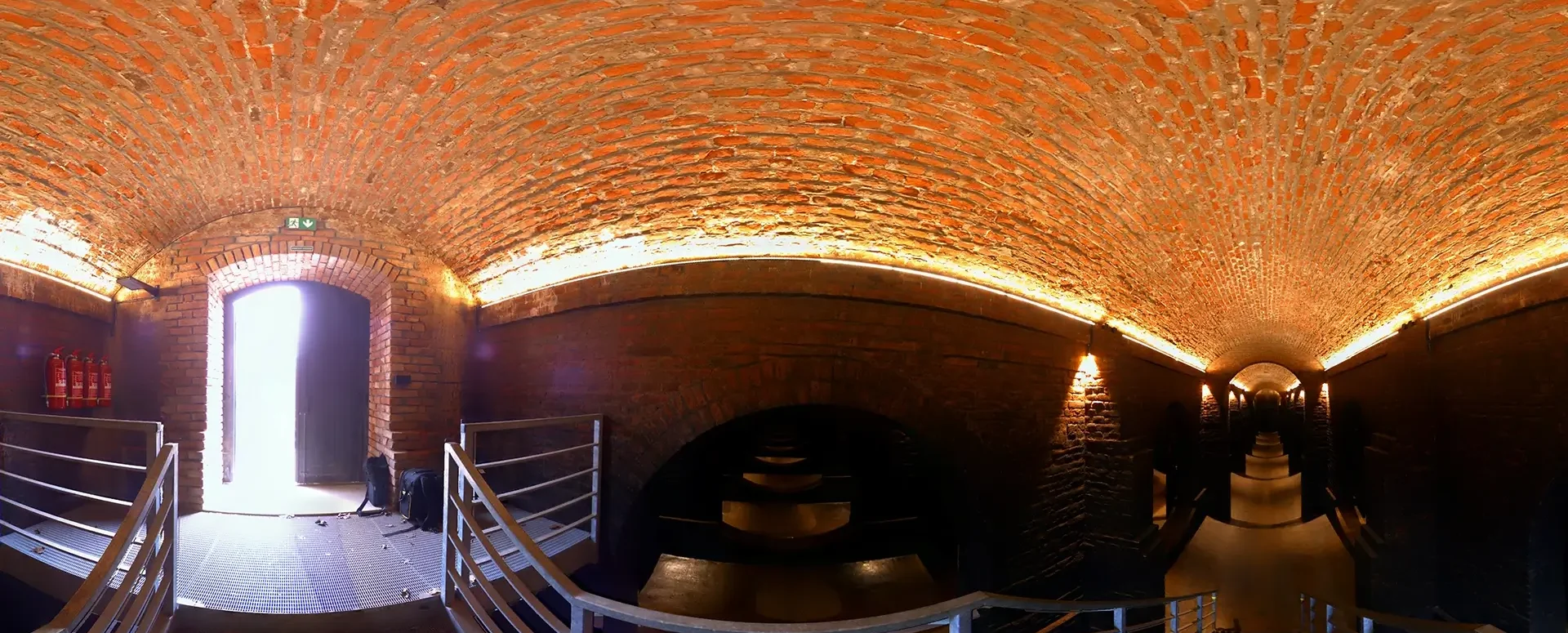
Visualization of the historic water towers on Žlutý kopec in Brno
Thanks to modern technology, you can “visit” these sights from the comfort of your own home.
An interesting project that took us back to the underground section of the Old Brno district. You’ll be able to explore the late 19th-century water reservoirs—which the city of Brno has decided to renovate and open to the public—at your leisure through their 3D visualization. But first, let’s recap the work process.
This year, our company surveyed and mapped the main entrance to the staircase of Water Tower No. 2 and the emergency exits for Water Towers No. 1 and 2. These staircases are already being used for guided tours of the water towers as part of the “Mysterious Underground” tour route. During construction, an additional request arose to mark out and survey the former guardhouse and the connecting underground passageway between the guardhouse and water towers No. 1 and No. 3.
The actual staking out and surveying were preceded by preparatory work, which included establishing a staking-out network (using a Trimble S5) connected to the S-JTSK (Unified Trigonometric Cadastral Network; GNSS method – Trimble R8) and, most importantly, communication with the designer. Since the project was not prepared in the S-JTSK coordinate system, we had to convert the entire project to S-JTSK.
A Trimble X7 scanner was used to scan a water tank with an area of approximately 2,050 m² (44.3 m x 46.3 m x 6 m), where the internal temperature ranged from 13 to 17 °C. With the help of control points set by our surveyors, it was referenced to the S-JTSK coordinate system.
The scanning of the water tower and its surroundings took two days and was performed from 200 scanning positions. During data processing, we found that the structure is also very precise, with a deviation from a right angle of only 0.19°. At a distance of 46 m, this amounts to a deviation of only about 15 cm. The advantage of this method over traditional surveying is the high speed of data collection, including the necessary details. In addition, the scanner also captures panoramic photographs, and if necessary, unclear areas can be examined using the photographs.
At this stage of construction, the main building work has been completed, and finishing work is currently underway on the structures and landscaping within the water reservoir complex. All of this is being handled by subcontractors, for whom we are also staking out and surveying, for example, sidewalks, street lighting, water service connections, and low-voltage (LV) lines and connections.
The public will also be able to tour the premises using 3D visualization. The advantage of this is, of course, not only the convenience, but also the fact that visitors can “visit” places that are not normally accessible to the public. The entire project was created using game engine technology, a sophisticated software framework commonly used in the field of computer games. The development process was based on the C# programming language and was specifically optimized for the web interface using the WebGL standard.
Creating such a complex visualization requires a wide range of skills typically used in the development of interactive virtual environments. “Hard surface” modeling involves the creation of solid structures, such as architectural and urban elements. On the other hand, “sculpting” focuses on creating organic shapes, which in this case involved creating a character. Other aspects, such as optimization for smooth application performance, user interface (UI/UX) design, and many others, are also essential for achieving a high-quality result.
You can learn more about our services on our BIM3D website.

More similar articles

Notice: Change to the MAWIS registration process, April 29–30
The transition to the new login method will take place on April 29. You will now use your email address. Please check your account.

Changes to the MAWIS Application Process – What to Expect and How to Prepare
We are preparing to switch to a new login method. You will now use your email address. Find out what this means for your account.
Changes to MAWIS Services Effective January 1, 2026
With the new year come several changes to MAWIS’s services. Below is an overview of the most important ones.


