Kamenice nad Lipou is modernizing its property management with a digital mapping portal
Kamenice nad Lipou is using the MawisGeoportal app to digitize its property management data and combine it with cadastral data, aerial photographs, and other information.
📖 Article in Moderní obec: Kamenice nad Lipou has embarked on a path toward smart asset management through data digitization.
The town of Kamenice nad Lipou in the Vysočina Region has embarked on a path of modern digitization and now uses the Mawis Geoportal mapping application from Hrdlička spol. s r.o. to manage its assets. This web-based mapping application combines maps and land registry data, aerial maps, and other public records with the town’s asset inventories, significantly simplifying and streamlining the administrative tasks for which Mawis Geoportal was deployed.
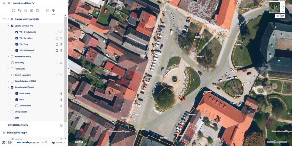
Main database in the map portal
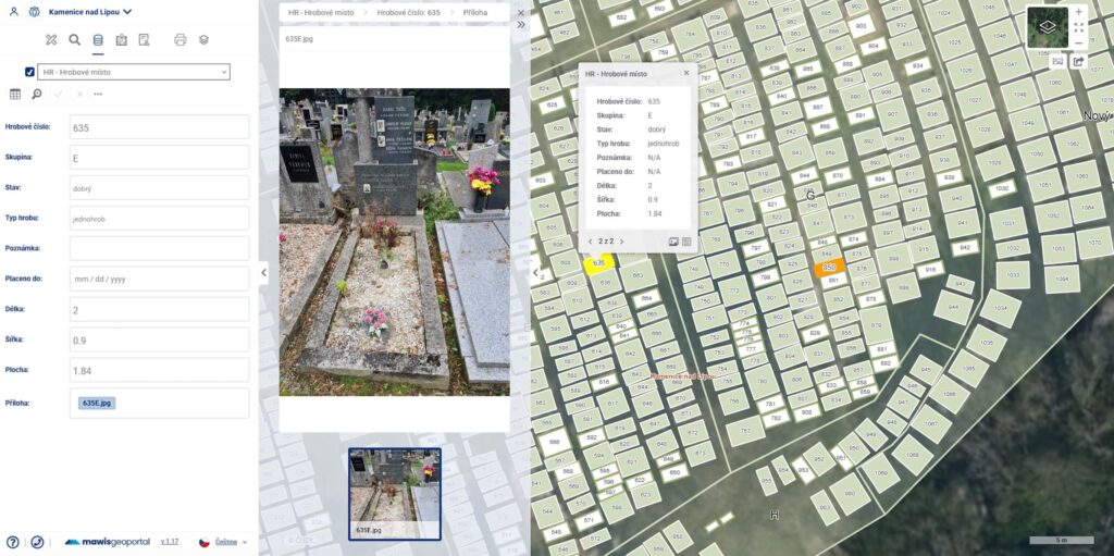
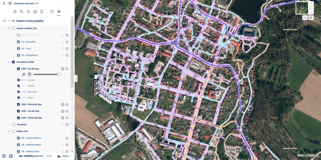
Employees of the municipal office in Kamenice nad Lipou use the Mawis Geoportal to maintain the public lighting inventory, the road inventory, the cemetery inventory, and to process requests for information regarding the location of utility networks.
A web application with data stored in the cloud allows agency employees to work with up-to-date data from virtually anywhere. Users can quickly add to and edit records, upload photos, and attach necessary contracts and other documents.
For more complex data tasks, staff members receive support from the vendor’s team of data analysts and GIS specialists.
Most Popular Features
According to city officials, the most useful feature of the new system is the ability to manage requests for statements regarding the existence of utility networks directly on the map. The feature that displays received requests directly on the map and allows them to be processed and saved along with the corresponding statements eliminates the need to maintain a separate record of requests and statements. Everything is clearly displayed on the map, and the case worker has access to map layers of the city’s utility networks to assess individual requests. This allows them to prepare statements more quickly and with greater accuracy by comparing the status of the networks with the polygon of the request area directly within the application.
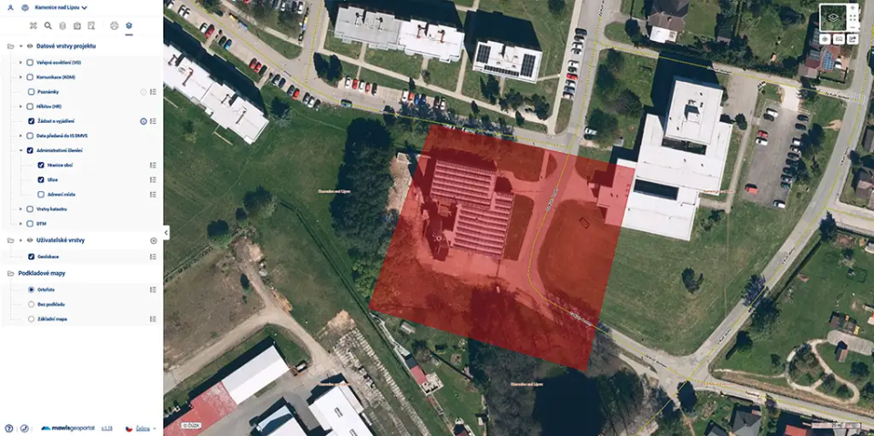
Another highly regarded feature is the ability to upload various types of drawings—including DGN, DWG, SHP, VFK, and XML formats—and view them. Staff members do not need specialized software to view the city’s project drawing documentation; they can open these files in the Geoportal, even in combination with maps of the city’s utility networks and property records.
The system also includes links to the real estate cadastre and the digital topographic model of the Czech Republic, providing users with a comprehensive overview.
City hall employees have come to appreciate the system’s simple and intuitive interface.
Digitization as the Way Forward
The example of the town of Kamenice nad Lipou shows that digitizing asset management can be a real benefit for cities and municipalities. Modern technologies simplify the day-to-day work of public officials and increase the efficiency of municipal asset management.
For more information on options for digitizing asset management in your municipality, please contact HRDLIČKA spol. s r.o.
What does Mr. Milan Procházka (City IT Specialist and GIS Administrator) have to say about the transition to the new system?
During the second half of 2024, we gradually transitioned from a system installed locally at stations to the web-based Mawis Geoportal. The main reason for the transition was the ability to work with the system from anywhere. The new system operates from the cloud via a web interface, so we are not tied to a connection to the city server. This allows us to access network routes and other information provided by the GIS directly in the field. A major bonus is the expanded functionality—particularly the ability to comment on the existence of networks directly within the system (which also keeps a record of individual comments). I’d also like to highlight the ability to enter our own data into the GIS—onto the map (information about street furniture, notes, photos)—and to view the provided maps and drawings in the appropriate drawing formats (dgn…). The entire new system is significantly more user-friendly.
Contact Information
Would you like to know more? Please don’t hesitate to contact us.
Ladislav Bláha +420 724 863 431 | ladislav.blaha@hrdlicka.cz
Miroslava Kubíčková +420 602 477 250 | miroslava.kubickova@hrdlicka.cz
30-day free trial of the geoportal

The Services Mentioned