
Digital Technical Map of the Czech Republic
We can help you with DTM
What is DTM CR?
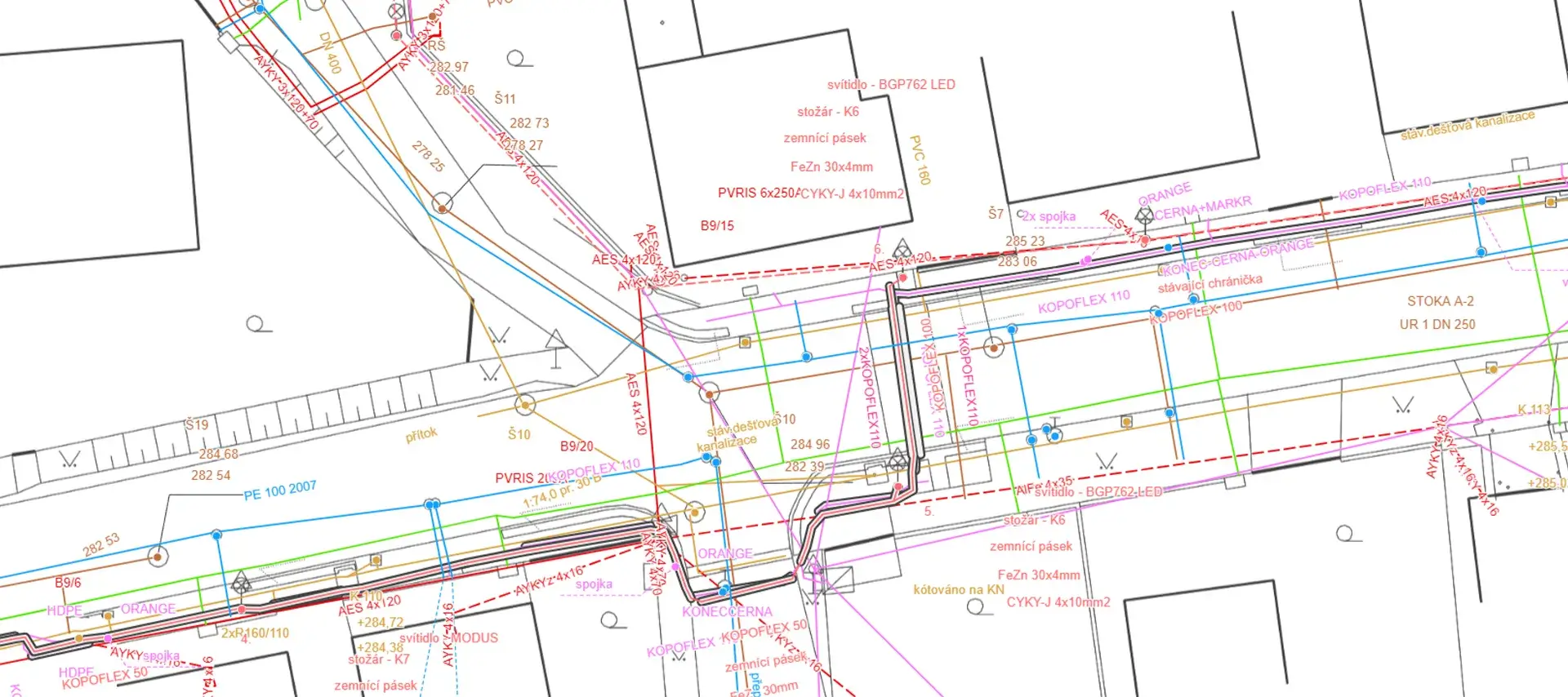
The Digital Technical Map (DTM CR) is a tool documenting the technical and transport infrastructure including ownership and legal relations. Act No. 47/2020 Coll. imposes the obligation to insert data into the digital technical map.
The DTM CR will make it easier to plan and negotiate construction projects on the territory of the Czech Republic in the future.
Every owner, manager and operator of a technical and transport infrastructure element is obliged to share the territorial and descriptive data on the element in the DTM CR.
The Unified Exchange Format of Digital Technical Maps (JVF DTM) is used for uploading, updating and issuing data.
We can arrange everything about DTM Czech Republic
DTM Czech Republic and Geoportal
We can help you with DTM. We can handle data creation and maintenance together!
Do you have a tool to manage your DTM data?
Mawis Geoportal can help you! It is used daily by technical infrastructure managers. Join us and start your first project with a better Geoportal.
Our partners in the DTM project


Blog articles

DTM CR – New tool for infrastructure management and planning
The DTM unifies previously fragmented data into a single digital model that can be used by both the public and private sectors.

DTM Czech Republic – important changes in building approvals
A significant legislative change that will affect the process of building approvals and obligations related to the Digital Technical Map of the Czech Republic.

Digital Technical Map of the Czech Republic and Geoportal application
How to effectively prepare utility data within the DTM CR project and how the Geoportal can facilitate their management.
 More information about the DTM CR project
I can help you with MAWIS services

Ladislav Bláha
expert consultant for MAWIS portal services