
Digital technical map and its importance for modern construction
The DTM CR simplifies construction processes, refines planning and improves the availability of infrastructure data.
Origin and initiators of the project
The Digital Technical Map of the Czech Republic (DTM) project was launched in 2018 at a conference in Mikulov with the signing of a Memorandum of Cooperation between key partners. Its implementation was mainly supported by the Association of Businesses in Geomatics (APG), which connected public administration with the business sector, and the ICT Union. The project was supported by EU funds and the active participation of the Association of Regions, which ensured uniform implementation throughout the Czech Republic.
Legislative framework and technological innovation
A major step was the amendment of legislation, including the Land Surveying Act and the new Act on Regional Digital Technical Maps. These standards define the content, format and accuracy of the data, making it possible to create a single national system. The DTM not only streamlines the construction process, but also brings new possibilities through the inclusion of a third dimension – height or depth, which provides data in 3D format.
Main benefits of the project
DTM CR is unique in its easy access to data on technical and transport infrastructure and the basic spatial situation on the territory of the whole country. Using the Unified Exchange Format (UEF), users can easily access up-to-date and accurate data, which significantly speeds up the preparatory phases of construction and reduces the risk of damage to existing infrastructure.
Data structure and content
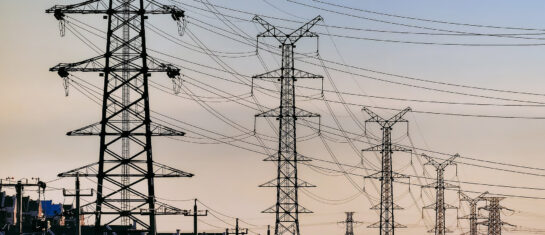
The system includes data on transport and technical infrastructure (e.g. power lines, water supply, sewerage, gas pipelines) and the basic spatial situation (points, lines and areas). The accuracy and integration of the data make the information useful not only for the construction industry, but also for crisis management and land development planning.
Availability and use
DTM data is available through county systems. Basic information is freely available, which promotes transparency and increases the efficiency of construction processes. In addition, the project is designed to be long-term, with continuous updating and refinement of data.
Importance for society
The digitalization of construction management, of which the DTM CR is becoming an important part, contributes significantly to increasing the efficiency and competitiveness of the Czech economy. The project facilitates the preparation of buildings, applications for building permits and the actual approval, thus speeding up the implementation of construction projects and supporting the modernisation of the entire sector.
Mawis and DTM
Thanks to the open data of the DTM CR, new services are being developed to help the public and professionals in dealing with situations during the life cycle of buildings. The Mawis portal is one such tool where administrators, builders, planners, municipalities and regions can access various digital services online.
MawisUtility is, for example, a service that allows bulk requests for comments on the existence of networks. This service greatly simplifies and speeds up the process of obtaining a complete overview of the utility managers in a specific construction area. It automatically sends electronic applications that are necessary to obtain a building permit.
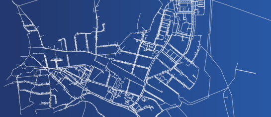
Another service is MawisGeoportal, a mapping application for visualising, publishing, managing and sharing geographic data and related documents. This tool allows for clear work with different data in space, facilitating strategic planning and asset management in a broader context. The Geoportal makes technical maps with utilities, property passports, cadastral maps and other mapping documents easily accessible.

More similar articles
DTM CR - New tool for infrastructure management and planning
The DTM unifies previously fragmented data into a single digital model that can be used by both the public and private sectors.

DTM Czech Republic - important changes in building approvals
A significant legislative change that will affect the process of building approvals and obligations related to the Digital Technical Map of the Czech Republic.
Digital Technical Map of the Czech Republic and Geoportal application
How to effectively prepare utility data within the DTM CR project and how the Geoportal can facilitate their management.