
MawisPhoto
3D mobile documentation
Cell phone. You can take a picture of the whole building without complicated technology.
3D construction data. Everything is in 3D and in dimensions to calculate cubature, area or length.
Accurate and fast. The models created have geodetic accuracy.
At any time. Record the progress of the work to track the costs charged.
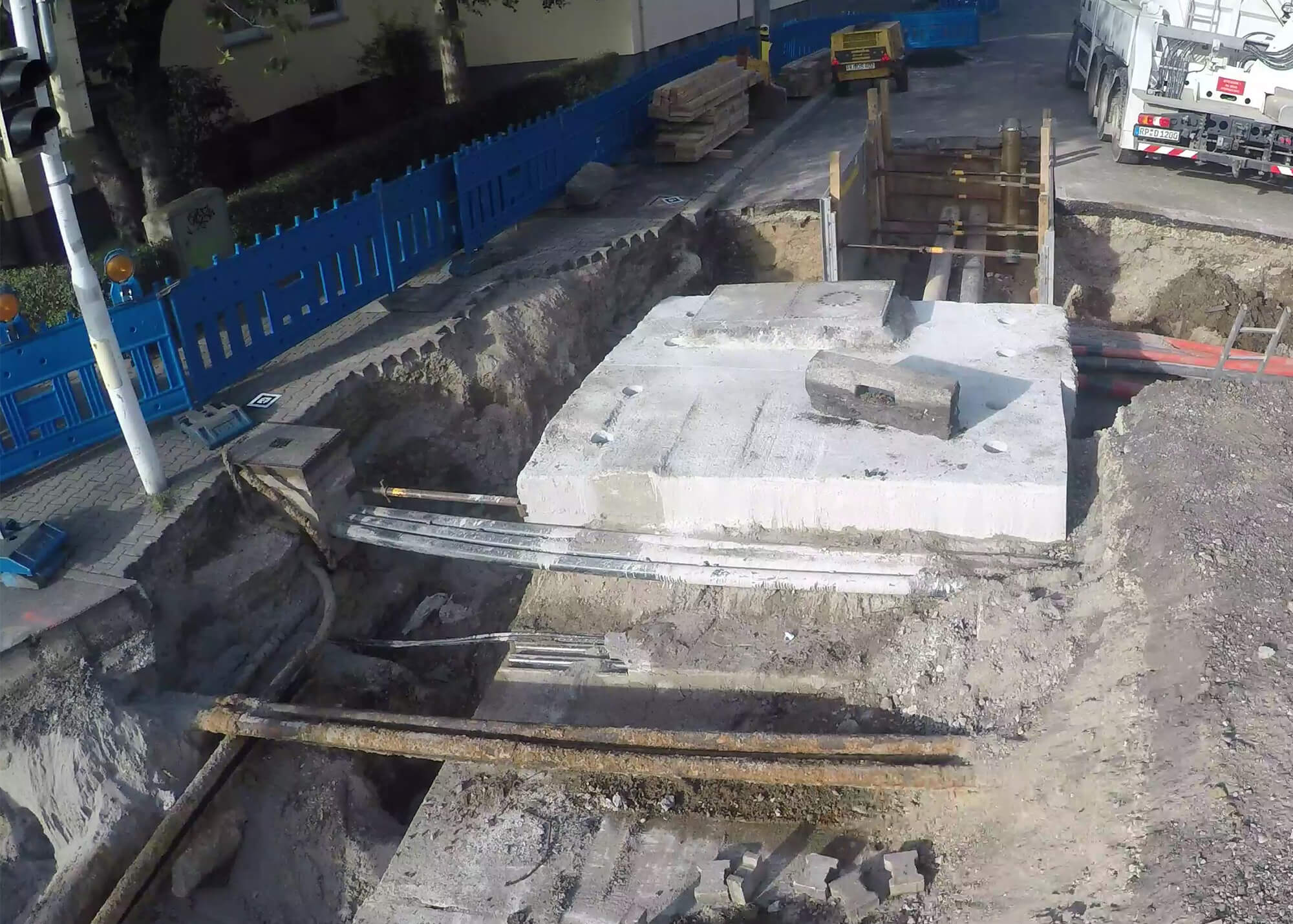
MawisPhoto can simplify construction documentation. It also quickly and accurately surveys subsurface situations prior to backfill. Using a 3D model that is geodetically accurate, you can also measure distances, areas, and cubatures. MawisPhoto records site work, checks site safety and can also track costs charged. All this with just a mobile phone.
The app allows you to safely yet accurately target hard-to-reach areas such as deep excavations.
Why MawisPhoto?
Acceleration of construction
MawisPhoto has a range of sophisticated innovative features for creating 3D data, construction documentation and measuring lengths, areas and volumes. With MawisPhoto you can make intermediate surveys instantly, speeding up construction significantly.
Strong security and availability
Through your profile, you can set up buildings and plan individual project documentation. All data is available online via computer, mobile and tablet – so you can see projects from anywhere. Of course, strong security is a must.
Setting roles and checking work
By setting access rights, you can easily determine who is allowed to work with your data and how. MawisPhoto can also serve as a checking tool, as it shows whether the work is already done. In the 3D model, you can easily check the status and volume of work done.
Collaboration over documentation
Usually more than one person is involved in the creation of the project documentation. MawisPhoto can connect them all over one data. This avoids duplication and confusion – collaboration and communication is significantly easier with MawisPhoto.
Accuracy
You can acquire construction data in accuracy class 3. The resulting 3D model is accurate enough to document the actual construction. Due to the accuracy, you can also use the 3D model for control measurements of lengths, areas and volumes.
Intuitive control
You can use MawisPhoto through a web browser or on your phone or tablet. The controls and functions are easy to understand for everyone. Thanks to the cloud solution, the data is always available and is also continuously backed up.
How does MawisPhoto work?
Want to see a MawisPhoto model?
Mobile applications
Use the MawisPhoto mobile app to take the video needed to calculate the 3D model. At the same time, it is possible to take photo documentation of significant objects of the building for further use. MawisPhoto is available for Android and iOS operating systems.
Web application
In the MawisPhoto web app, you create a project in which you can manage each building in turn. You can view and share the 3D model and find out distances, areas and cubatures.
Price list
Choose the tariff that’s right for you. With more credits, you can create models cheaper.
Learn about MawisPhoto pricing and how to redeem credits in the app.
Standard
- Number of credits: 2 200 credits
- Data storage: 1 year free
- Full app functionality: web | mobile | 3D model viewer
- Basic set of equipment for placing 3D models in: scale | coordinates
- Training on how to use the system and how to capture data: online | in person
- Technical support: telephone | online
- Unlimited number of users
Premium
- Number of credits: 7 000 credits
- Data storage: 1 year free
- Full app functionality: web | mobile | 3D model viewer
- Basic set of equipment for placing 3D models in: scale | coordinates
- Training on how to use the system and how to capture data: online | in person
- Technical support: telephone | online
- Unlimited number of users
Enterprise
- Number of credits: 44 000 credits
- Data storage: 1 year free
- Full app functionality: web | mobile | 3D model viewer
- 3 basic equipment sets for placing 3D models in: scale | coordinates
- Training on how to use the system and how to capture data: online | in person
- Technical support: telephone | online
- Unlimited number of users

Ondřej Hrdlička
expert consultant for MAWIS portal services