Searching for the affected plots with the owners
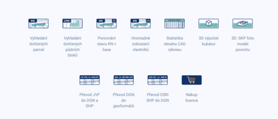
MawisTools tools automate and accelerate the processes of locating affected parcels, including ownership relationships.
In the field of utility design, property settlement, and property management, it is crucial to have up-to-date cadastral data. Instead of lengthy searches for information on individual parcels, it is much more efficient to obtain it in bulk for the entire area of interest.
That is why the MawisTools library was created to make it easier for users to obtain basic information about parcels and their owners. The individual tools link digital drawings with cadastral data and, thanks to data analysis, provide a range of other useful information such as information on neighbouring parcels, the occurrence of easements or comparison of data over time.
1. Search for affected plots: in bulk for your drawings
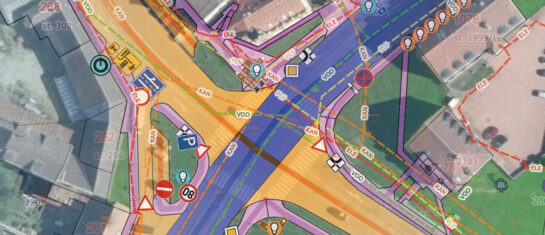
The Affected Parcel Search tool allows you to bulk search for information about parcels based on an inserted drawing in DGN, DWG or SHP format. This drawing is projected onto the cadastral map and the tool automatically identifies the parcels concerned. The result is not only a list of affected parcels including their neighbours, but also DGN drawings with their geometries, which facilitates further work with the data.
A great advantage for users is the connection with the online service “Looking into the CN”, which provides detailed information about specific properties, including ownership relations.
2. Bulk view of owners: the key to property settlement
One of the most frequent needs of planners and investors is to quickly establish the ownership of a large number of parcels. Ordinary users are not allowed to access this information in bulk for data protection reasons, but MawisTools makes this functionality available through the Web Service for Remote Access (WSDP).
With the Bulk display of owners tool, the current owners from the land register are added to the existing list of parcels. This data is provided in an excel spreadsheet, allowing for easy further analysis and processing.
This feature is particularly useful when:
- Property law settlements in planning land purchases for various buildings.
- Analysis of ownership relations for various development and investment projects.
3. Comparison of cadastral status over time.
Managing real estate or designing infrastructure projects often requires not only up-to-date information, but also historical comparisons. MawisTools therefore offers a Temporal Comparison function for land registry data, which allows you to identify changes in the geometry and area of parcels over time.
This functionality is particularly useful when:
- Check the validity of the parcels including their current acreage and geometry.
- Monitoring changes in the cadastre that may have an impact on ownership or investment.
- Preparation and updating of project documents for construction and infrastructure projects.
The output is clear reports and DGN drawings that clearly show any changes, making decision-making and data management easier.
Conclusion:MawisTools – a powerful helper for working with cadastral data
MawisTools is a useful solution for designers, surveyors, developers and property managers. They automate and accelerate the processes of locating affected parcels, including ownership relationships, and analyze changes to land registry parcels over time.
Users can plan, make decisions and work more efficiently with up-to-date cadastral data.
MawisTools for 30 days free
Do you need any advice? We are ready by email and phone.
Ladislav Bláha

More similar articles
MawisTools - Advanced tool library for surveyors, planners and geoinformaticians
From the search of the parcels concerned to the calculation of cubatures or the conversion of data formats. Fast, online and without installation.

Conversion of JVF DTM to DGN and SHP - new MawisTools tool
The converter allows you to create a drawing in DGN/SHP formats from JVF DTM data that you can view in your favorite application.
Municipal asset passporting - modern management using Mawis
The MawisPasport service will help municipalities to unify and digitise their records, making them available to all who need them.